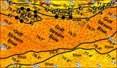
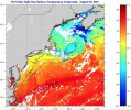
On my list for this winter in FL. The big rig I fish the WMO and MidAtlantic tournaments on just upgraded to all latest Furuno equipment including SIRIUS fishing weather. I'll let you know next week. We also have a full ROFFS service each year.
ROFFS actively analyzes every sat shot during the tournament season. They build a mosaic of all exposed ocean areas. Eddys are identified, direction and speed are noted, water color devined or ground truth, fishing reports factored in and daily analysis is delivered the night before. It's as good as it gets but it is static. We sat phone in several times a day to exchange information. They don't do weather.
In the past SIRIUS SST for NE canyons tracked ROFFS accurately. In fact we seemed to get accurate SST when ROFFS reported cloud coverage. No idea how because all services use the same satellites.
The water changes slower in NE canyons then in Florida straights. In the Florida keys the water will dramatically change through the day. Micro-eddy's come in bringing pockets of blue water onto the reef and disappear in a few hours. I have not tried SIRIUS in the keys yet but plan to. ROFFS analysis for one day in keys attached.
We use Buoy Weather, Fish Weather and NOAA. SIRIUS weather on the chart overlay. The first three for planning and SIRIUS for real-time on the water weather.
SIRIUS fish package is $100/month. Not that expensive for what you get. They allow you to suspend the service for your off season.
ROFFER'S OCEAN FISHING FORECASTING SERVICE, INC. TOLL FREE 800 677-7633 & (321) 723-5759 // EMAIL:
FISH7@ROFFS.COM
ROFFS™ FISHERIES OCEANOGRAPHIC ANALYSIS FOR THE KEY LARGO TO SUGARLOAF KEY AREA (LAT./LONG.) UPDATED ON MON. 26 FEBRUARY 2018 FOR MON. P.M. & TUES. FISHING ONLY
Based on a multiple factor analysis, the symbols (hot spot spots) mark the areas where bait concentrations are expected and where fishing action is expected to be better compared with other (non-marked) areas. These are not based on dock rumors or hearsay fishing reports. Fishing reports are stated as such. You should start fishing where you recognize other signs of good fishing conditions near these marked areas. It is very important to use your sea surface temperature (sst°) gauge to locate the boundaries of the water masses, which are outlined. Rather than trying to find water based on the absolute temperature values shown on the map, search for the relative change in sst where the water mass boundaries occur. Arrows indicate the main current direction. Numbers inside of the dots indicate the number of consecutive days that we have seen favorable conditions in that location.
We were able to use today’s SST imagery and MODIS ocean color/chlorophyll imagery for this analysis area and were able to follow the oceanographic conditions for the past four days. Overall, we have observed two Gulf Stream eddy formations within this chart area. A relatively large eddy is located south of Marathon Key over 100-150 fathom depths (centered near 81°12’W & 24°27’N). This eddy is expected to be offshore of Islamorada by tomorrow morning. A second, smaller eddy is located offshore of Long Key over 20-50 fathom depths (centered near 80°47’W & 24°43’N). This eddy is expected to be offshore of Tavernier to Key Largo by tomorrow morning.
With this in mind, your better chances for sailfish fishing action are likely to occur in the east of this chart area. Heading out of Islamorada, begin fishing over the 10-20 fathom depths just offshore (near 80°35’W & 24°53’N) where favorable (77°F-78°F) water mass boundary conditions have been observed for four days. From here, work your way northeastward along the 20 fathom curve towards the Elbow (from near 80°22’W & 24°57’N to 80°17’W & 25°10’N) where similar favorable water mass boundary conditions have also been observed for four days. These conditions suggest good chances for fishing action to occur. Over 80-100 fathom good bottom offshore Islamorada (near 80°22’W & 24°49’N) favorable (78°F-79°F) water mass boundary conditions have been observed for three days, suggesting additional good chances for fishing action to occur.
Heading southwest of Islamorada, and south of Matecumbe Key, over 20-30 fathom depths (near 80°42’W & 24°46’N) favorable (77°F-78°F) water mass boundary conditions have been observed for three days. Southwest of Long Key over 15-30 fathom good bottom and wrecks (near 80°54’W & 24°42’N) and southeast of Marathon Key (near 80°58’W & 24°40’N) similar favorable water mass boundary conditions have been observed for three to four days. These conditions suggest good chances for fishing action to occur.
South of Marathon, over 100 fathom depths and good bottom (from near 81°08’W & 24°30’N to 81°18’W & 24°28’N) favorable (78°F-79°F) blue green to blue water mass boundary conditions have been observed for four days. Inshore, over 20 fathom depths (near 81°27’W & 24°32’N) favorable (77°F-78°F) green to blue green water mass boundary conditions have also been observed for four days. These conditions suggest good chances for fishing action to occur as well.
In the evening if you would like to discuss your ROFFS™ Fishing Oceanographic Analysis with an analyst after you receive it, then call our office by 5:00 PM eastern. Otherwise our fisheries oceanographic analysts are likely to be unreachable. Call anytime during the day and we will connect you with an analyst as time permits.
ROFFS™ Fall/ Winter Hours: Mon – Fri. 9 : 00 am – 5 :00 pm. We are now closed on Saturdays. Thank you for not sharing this analysis with non-paying fishermen. Remember you can order and/or purchase your fishing analyses from our website (http://www.roffs.com/) or by email (fish7@roffs.com). Verbal updates are free between 10: 30 AM and 11: 59 AM ( eastern time) only.
e ROFFS™ Graphic analysis is on the next page.


marine.rutgers.edu
marine.rutgers.edu


