Garmin Navionics+ and Garmin Navionics Vision+ Sale

Joined
Jan 17, 2023
Messages
22
Reaction score
4
Points
3
Age
55
Model
Seafarer
I just purchased the US East Navionics charts for $149.99 two weeks ago, for my Garmin Echomap UHD 73SV. This was NOT the Vision+ version with the relief shading, so I was initially kicking myself when I read that the Navionics Vision+ NVUS007 was on sale for the SAME PRICE as the version I bought. I called Garmin to see if they could help me out. They issued a return authorization for my previous chart, and I'll get fully refunded for the cost. I purchased the download version of NVUS007 and the relief shading was immediately available on Active Captain. I studied Garmin's chartplotter compatibility tables, and I don't expect any issues transferring the charts to my unit (the boat is 60 miles away). I'm heading for some offshore sites in SC in a week for kingfish. I'm super happy that Garmin allowed the return.
 

Recoil Rob

Well-Known Member
Joined
Mar 23, 2019
Messages
295
Reaction score
55
Points
28
Age
69
Location
CT Coast
Model
Sportsman
What a PITA...I bought the NVUS007 US East download. I put a new 32Gb SD card in my 943xsv. I used an iPad to download the charts I wanted using the moving box thing they have. The 943 network sees the iPad and connects and it updates everything except the maps. I get the great relief shading maps on the iPad but not on the 943, the card (which was formatted and selected to be the AC card?, is empty.

I went to Garmin's online help, and di as they recommended, deleted everything and started over, still the same.

I must have wasted 4-5 hours on this already and it will turn out to be something simple I'm sure...

Garmin closed on weekends so any ideas?
 

Hookup1

GreatGrady Captain
Joined
Oct 16, 2007
Messages
3,035
Reaction score
855
Points
113
Age
70
Location
Cape May, NJ
Model
Islander
Relax...this all works. Trust me.

When you say you deleted everything what does that mean?

When you Home > Charts and select Shaded Relief go the unit you don't get shaded relief? Zoom in close to shore - still nothing?
 
Last edited:

Hookup1

GreatGrady Captain
Joined
Oct 16, 2007
Messages
3,035
Reaction score
855
Points
113
Age
70
Location
Cape May, NJ
Model
Islander
What I would do is go to Active Captain (AC), select charts on the bottom of the screen, zoom to a large area and delete all or just try Delete All. Make sure you are connected to the internet.

When all charts are deleted go to Download Charts and select an the area you want. A little bigger is ok but don't try to load everything! Then Download. Could take an hour!

When that finishes switch the network to the boat's wifi. In AC go to Boat Apps and select one of the units. Go to Vessel > Active Captain > OneChart. The unit should start downloading and then will verify. This also takes a long time. Let it finish.

Go back to Home > Charts > Shaded Relief. Check them out.
 

Hookup1

GreatGrady Captain
Joined
Oct 16, 2007
Messages
3,035
Reaction score
855
Points
113
Age
70
Location
Cape May, NJ
Model
Islander
What a PITA...I bought the NVUS007 US East download. I put a new 32Gb SD card in my 943xsv. I used an iPad to download the charts I wanted using the moving box thing they have.
When download finished on the iPad you need to switch network from the internet to the boat's wifi. This will upload charts and verify them. This is an hour plus! You can watch it happen on the unit on the Active Captain screen. This should have installed the charts on your units.
The 943 network sees the iPad and connects and it updates everything except the maps. I get the great relief shading maps on the iPad but not on the 943, the card (which was formatted and selected to be the AC card?, is empty.
Charts regions typically take up 2GB +/-.
 

SkunkBoat

Well-Known Member
Joined
Oct 12, 2017
Messages
4,508
Reaction score
1,614
Points
113
Location
Manasquan Inlet NJ
Website
www.youtube.com
Model
Express 265
I have a GPSMAP 1242 touch plus and an EchoMap74 UHD. The Echo is much slower to get everything. I found that the maps and shaded relief did not show up on the units at the same time
You will see shaded relief in menu but still not have the shaded map until a long process of "Transferring" and "Validating" multiple times. let it run...walk away....
 
Last edited:

Hookup1

GreatGrady Captain
Joined
Oct 16, 2007
Messages
3,035
Reaction score
855
Points
113
Age
70
Location
Cape May, NJ
Model
Islander
You will see shaded relief in menu but still not have the shaded map until a long process of "Transferring" and "Validating" multiple times.
I have seen this also. Seems better to do one region and let it upload and validate. Don't try to do too much. Mine was predictable (after doing this several time last week and this weekend!). PITA!
 

Recoil Rob

Well-Known Member
Joined
Mar 23, 2019
Messages
295
Reaction score
55
Points
28
Age
69
Location
CT Coast
Model
Sportsman
I have tried all the suggestions. When I said 'delete evreything" I meant that Garmin's online help states if it doesn't work start over. I have done that twice.

I know about switching the wifi. After downloading charts to the iPad I switch the wifi to the 943's Garmin network, it sees the iPad but does not download charts. It does update Garmin Comm and one other item so I know the comms betwenn the iPad and the 943 are working.

I have no option for shaded relief in the 943's Chart menu because the charts have not uploaded from the iPad. I have 12Gb of charts on the iPad in AC but the 943 states that the 32Gb card only has 800Mb used, no charts have been uploaded.
 

Recoil Rob

Well-Known Member
Joined
Mar 23, 2019
Messages
295
Reaction score
55
Points
28
Age
69
Location
CT Coast
Model
Sportsman
"When all charts are deleted go to Download Charts and select an the area you want. A little bigger is ok but don't try to load everything! Then Download. Could take an hour!

When that finishes switch the network to the boat's wifi. In AC go to Boat Apps and select one of the units. Go to Vessel > Active Captain > OneChart. The unit should start downloading and then will verify. This also takes a long time. Let it finish."

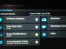
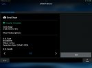
Here's what I get after that, notice no card usage...3mb/30gb (0%)

IMG_3703.JPG

IMG_3707.JPG


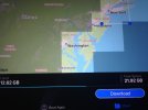
Here's the chart area and memory usage on the iPad AC ...12.62 GB


IMG_3706.JPG

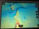
Here's the chart on the iPad...

IMG_3704.JPG


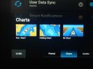
there is no shaded relief option on the 943...


IMG_3708.JPG
 

Hookup1

GreatGrady Captain
Joined
Oct 16, 2007
Messages
3,035
Reaction score
855
Points
113
Age
70
Location
Cape May, NJ
Model
Islander
You are doing everything right. Let’s go over a few things.

If you go to AC Boat Apps > Helm you see both units and can work them ok?

You should have only one microSD card in the system. Take the other one out if you haven’t done so.

I have found that download charts and uploading works best one section at a time. Get it working 100% before adding another. If I did too many sections have I had cases where it never finished downloading and uploading.

Did you take the AC card out and reformat on a PC before starting over? This will reset AC.

I have been trying to get my second Vision+ region working. NJ and FL Keys areas. All last week and weekend. Got it settled down Sunday.

You can talk to Garmin to hear their recommendations. I would make sure units and charts are registered with Garmin.com account and in the iPad AC MyCharts and the units AC.

If good you can try deleting all the charts in iPad AC and downloading a small section, uploading and checking.

You could also reformat the SD card and try above. You need to get a small section to work before spending too much time on long download.
 
Last edited:

Recoil Rob

Well-Known Member
Joined
Mar 23, 2019
Messages
295
Reaction score
55
Points
28
Age
69
Location
CT Coast
Model
Sportsman
You are doing everything right. Let’s go over a few things.
If you go to AC Boat Apps > Helm you see both units and can work them ok?
I'm doing this at home, I have the newer unit hooked up to a battery from the boat. Garmin did say that I only had to load the charts onto the newer unit and that the older unit would display them when they are networked together. At the Helm I can see both units because they are both registered
You should have only one microSD card in the system. Take the other one out if you haven’t done so.
I replaced the 16GB that came with the unit with a new 32GB as Garmin suggested. But I have tried this with the original 16GB, still didn't work.
I have found that download charts and uploading works best one section at a time. Get it working 100% before adding another. If I did too many sections have I had cases where it never finished downloading and uploading.
I never see it start to download. Where exactly will I see the progresbar/spinning wheel that shows a download in progress?
Did you take the AC card out and reformat on a PC before starting over? This will reset AC.
I bought a pack of 2 SD cards, tried them both. The 943 asked if I wanted to format them, I agreed and did it.
I have been trying to get my second Vision+ region working. NJ and FL Keys areas. All last week and weekend. Got it settled down Sunday.

You can talk to Garmin to hear their recommendations. I would make sure units and charts are registered with Garmin.com account and in the iPad AC MyCharts and the units AC.
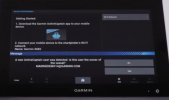
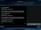
Everything is registered. I have watched the Garmin tutorial on Youtube several times, here is the screen it states I should see when switching the iPad back to the Garmin network that will start the download, I never see this screen...


Screen Shot 2023-06-05 at 9.23.55 AM.jpg
If good you can try deleting all the charts in iPad AC and downloading a small section, uploading and checking.
Have a call in to Garmin first
You could also reformat the SD card and try above. You need to get a small section to work before spending too much time on long download.
 

Hookup1

GreatGrady Captain
Joined
Oct 16, 2007
Messages
3,035
Reaction score
855
Points
113
Age
70
Location
Cape May, NJ
Model
Islander
Here are a few screenshots from my unit/iPad.

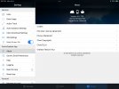
On your iPad go to Active Captain Settings > Chart Download Settings. I have Relief Shading, Satellite Imagery and Sonar Imagery selected.

On your iPad go to Active Captain Settings > About. Check the top You should be Logged in as: RECOIL@OPTIMUM.NET
IMG_0023.jpeg

Now go to your unit and check the main Active Captain screen. In the upper left corner. Owner: should be RECOIL on both units.
Also look at usage. Mine shows Used: 3GB Free: 26GB.

IMG_0019.jpeg IMG_0024.jpeg

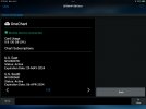
Now I have two units. 8610 and 8612. The 8612 has the 32GB Active Captain SD card in it. NJ and FL Keys areas are loaded. The 8610 shows 3GB and 30GB available. The 8612 shows 3GB and 30GB available. Check Active Captain OneChart on both of your units. Your image above shows 30MB and 30GB available. That looks like a Active Captain Card that has been setup but has no charts transferred to it.

IMG_0022.jpeg

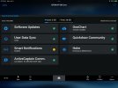
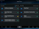
Last thing to check is Chart subscriptions. On your unit, Active Captain ...Options > Settings > System > System Information > Chart Subscriptions. This is just a double check of the OneChart info.

IMG_0020.jpeg

My suspicion is that something is not registered properly. Go to Garmin.com, login to your account with RECOIL@OPTIMUM.NET select Manage Your Data > View Your Data > View Device Information and confirm everything is correct.

Screen Shot 2023-06-04 at 2.08.54 PM.png
 

Attachments

  • IMG_0021.jpeg
    IMG_0021.jpeg
    199.8 KB · Views: 2
Last edited:

Hookup1

GreatGrady Captain
Joined
Oct 16, 2007
Messages
3,035
Reaction score
855
Points
113
Age
70
Location
Cape May, NJ
Model
Islander
Was the new unit "New" or did you buy a previously used one? If it was a used one it's best to do a system reset.

Check all your information as above.Something isn't right.

As far a watching the download/upload progress:
I use AC on the iPad, connected to the internet, select an area and click download. The progress shows on the bottom of the screen.

When that completes I switch to the boat network and go to AC > Boat Apps. I watch for the Sync with Plotter icon starts to show progress.

At this point I use the Helm and bring up AC. You can just go to your unit (mine is outside up on the boat). I then go to OneChart and watch the progress.

Hope this helps!
 

Recoil Rob

Well-Known Member
Joined
Mar 23, 2019
Messages
295
Reaction score
55
Points
28
Age
69
Location
CT Coast
Model
Sportsman
New unit is new, out of box.

I just finished working with a very patient Garmin tech. We started from scratch, deleted the AC app from iPad. Reformatted SD card to MS Dos FAT on my PC, this was something I hadn't tried.

Also,on the iPad, in Chart Download settings, I only checked the first 4 actual chart settings, unchecked the last 2, Community and Quickdraw.

I downloaded a smaller chart to iPad and it transferred to the 943. Success! I'll upload smaller chunks after the initial one.

FYI, since I am not renewing the subscription after 1 year I'll try to repeat the process with another SD card to have a B/U.

Thanks for all your help Hookup, you were correct in that best to do smaller chunks. Seems to me this should be simpler but I guess that for owners with units dash mounted this may be the best option. I am working with it in my living room, with the boats house battery on the floor... ;)


IMG_3709.JPG
 

Attachments

  • IMG_3709.JPG
    IMG_3709.JPG
    140.5 KB · Views: 0

Hookup1

GreatGrady Captain
Joined
Oct 16, 2007
Messages
3,035
Reaction score
855
Points
113
Age
70
Location
Cape May, NJ
Model
Islander
For someone who doesn't consider themselves a techie you did good! This Active Captain chart loading is a mystery - Garmin doesn't tell you what is going on.

FYI - You can still download charts with Active Captain after your subscription expires. You just don't get any of the updates. For us recreational boaters this isn't a big deal.

When you install this chartplotter in the boat make sure you pull the Active Captain card out of the boat unit. One one AC card per system.
 

SkunkBoat

Well-Known Member
Joined
Oct 12, 2017
Messages
4,508
Reaction score
1,614
Points
113
Location
Manasquan Inlet NJ
Website
www.youtube.com
Model
Express 265
One other thing. Stay on the AC screen on your iPhone/ iPad. I think going to a different app while you’re downloading disconnects you from the Wi-Fi unit
 

SkunkBoat

Well-Known Member
Joined
Oct 12, 2017
Messages
4,508
Reaction score
1,614
Points
113
Location
Manasquan Inlet NJ
Website
www.youtube.com
Model
Express 265
I went thru the same ordeal with the Echo73. Twice! The new unit lost a full line of pixels after a just three uses. I had to go thru the whole thing again with the replacement unit.
You learn to be patient...
 

glacierbaze

Well-Known Member
Joined
Jul 6, 2012
Messages
2,488
Reaction score
644
Points
113
Age
75
Location
Chapel Hill and Pine Knoll Shores, NC
Model
Seafarer
I have two 93SV's, that I am pretty sure are pre-2018, I bought one from someone here, and the other on CL. Still running G2 Vision, and I get one foot contour lines on the fishing chart, but not the navigation chart, and I get relief shading.
 

Hookup1

GreatGrady Captain
Joined
Oct 16, 2007
Messages
3,035
Reaction score
855
Points
113
Age
70
Location
Cape May, NJ
Model
Islander
I have two 93SV's, that I am pretty sure are pre-2018, I bought one from someone here, and the other on CL. Still running G2 Vision, and I get one foot contour lines on the fishing chart, but not the navigation chart, and I get relief shading.
Maybe Bluechart g3 Vision. Garmin bought Navionics around that time. They merged the Navionics data with Bluechart. The look is a little different. Garmin is moving away from Bluechart to Garmin Navionics+ and Vision+ and shipping most chart plotters with these charts.