Hookup1
GreatGrady Captain
- Joined
- Oct 16, 2007
- Messages
- 3,577
- Reaction score
- 1,011
- Points
- 113
- Age
- 71
- Location
- Cape May, NJ
- Model
- Islander
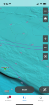
Those "tracks" that you see offshore are from the bottom mapping scans. They mapped high resolution tracks over earlier low resolution map. This added more detail to interesting bottom areas - like where a Russian sub might hide! Inshore areas are mapped differently - not sure how it's done.anybody know what those patterns are on relief shading they start to show up at around 600ft
View attachment 35991
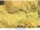
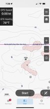
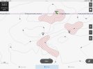
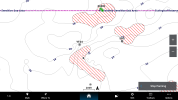
The shaded relief maps are raster maps (images). If you zoom in to say 200' scale on any device you will see exactly the same detail regardless of device screen resolution. What is different is the "frame" around the spot will be larger or smaller. Take a look at these iPhone, iPad and 8612 screen shots.
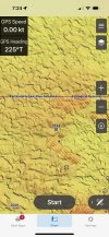
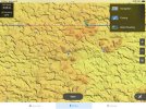
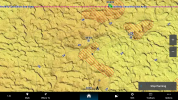
If you zoom in on any of the shaded relied charts on any of the devices they will "pixellate" the raster image. Fishing and navigation charts are vector charts. You can zoom smoothly to any scale.
Fishing and navigation charts will behave the same way with different resolution devices. At 200' scale you will see more or less around you depending on the device. This makes a big difference when you need detail and to see a larger area at the same time. More resolution (not screen size) does make a difference.
Last edited:


