Garmin Setup Magnetic or True

Hookup1

GreatGrady Captain
Joined
Oct 16, 2007
Messages
3,035
Reaction score
855
Points
113
Age
70
Location
Cape May, NJ
Model
Islander
I have a Garmin 24xd with a magnetic heading sensor. I need it to correct my direction on the radar overlay. The chart plotter can be setup either way. How are you setting your up? True or magnetic?
 

Hookup1

GreatGrady Captain
Joined
Oct 16, 2007
Messages
3,035
Reaction score
855
Points
113
Age
70
Location
Cape May, NJ
Model
Islander
Well I'm not sure about that. If you don't have a magnetic sensor source the radar uses the GPS course over ground (COG). This works fine until you stop or slow down (like in the fog). The GPS position is accurate but the GPS COG is unreliable/unusable.

If you install a magnetic sensor you now have a magnetic heading source (Heading) in addition to the GPS COG. Does the radar ignore the GPS COG and only use the magnetic Heading? Is this true at all speeds (does it switch)? Should the radar be set to magnetic?

Do the charts use the magnetic heading sensor? Or do they only use GPS information?
 
Last edited:

SkunkBoat

Well-Known Member
Joined
Oct 12, 2017
Messages
4,509
Reaction score
1,614
Points
113
Location
Manasquan Inlet NJ
Website
www.youtube.com
Model
Express 265
I have Garmin Fantom 24 and Reactor40 AP. The system uses the heading from the AP CCU sensor.
I switched to TRUE display. It makes more sense to me because True North is straight up on the chart instead of 13 degrees off for MagNorth
I use the AP and chartplotter to navigate not the compass.

Trying to remember the steps. You have to make sure evrything is set TRUE Chart setup,Orientation and Radar Setup , Orientation
Somewhere it says taht North Reference is shared over Garmin Network so changing it on one MFD changes them all....supposedly....
Then check all off your Overlay data bars to make sure they are degrees T not degrees M


...and you are not using GPS heading.

Screen Shot 2022-04-22 at 8.55.09 PM.png
Then set the RADAR "front of boat" offset to line up known points (tall channel markers at the tip of a jetty)
 

Hookup1

GreatGrady Captain
Joined
Oct 16, 2007
Messages
3,035
Reaction score
855
Points
113
Age
70
Location
Cape May, NJ
Model
Islander
COG - A Complete Definition
It is the path the boat travels relative to the bottom, no matter which way you're sailing. COG is not Heading. The heading is the compass direction your boat is pointing, and it may not match COG if you have current and tidal effects.

So it appears that the chartplotter will use COG if no HEADING is presented and that it will use HEADING all the time if it is present.
Edit 4/25/22: Garmin units will use magnetic Heading up to 3.5 knots (settable) and COG above that speed.

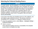
The GPS system is fixed to the "true North". Garmin defaults to "true North". I'll leave them alone for now.

I'm still not clear on the heading sensor. It's a magnetic device. There is a auto calibrate procedure to spin the boat a few times and you're done. I have not found any documentation that discusses "true North" or "Magnetic North". I'm going to assume that Garmin uses the COG information to correct the magnetic headings during calibration. Next time I'm out on the water in the Cape May canal or other tight waterway I can check my calibration.
 
Last edited:

SkunkBoat

Well-Known Member
Joined
Oct 12, 2017
Messages
4,509
Reaction score
1,614
Points
113
Location
Manasquan Inlet NJ
Website
www.youtube.com
Model
Express 265
I agree the Garmin manuals don't say enough.

Things can be set to display in deg T or deg M. It just does the same offset you would do based on your local deviation.

That doesn't change how it gets Hdg or COG or Bearing to target. If you have a Heading sensor(magnetic) and it is set as the default then the system will compensate for the deviation (as you said it is calibrated). If it uses GPS all it can do is use COG. (I think there are new heading sensors that use multiple gps antennas that can calculate Heading even at rest)

A way to check what is being used is when you are at the dock or in your driveway.... where is your bow pointing? Does your plotter show that? Is it correct?
If you don't have a Heading sensor the chartplotter will show you pointed north (hmmm or maybe the last COG it remembers??

On a long run back in 3 to 5 , SW at +20knts, I have seen my heading line not pointing along my track(COG).
 

seasick

Well-Known Member
Joined
Aug 19, 2008
Messages
9,531
Reaction score
1,420
Points
113
Location
NYC
I use magnetic because I like my display and compass to agree so that I know my compass is working. That said, I don't go that far out usually.
 
  • Like
Reactions: FirstTimeGrady

Hookup1

GreatGrady Captain
Joined
Oct 16, 2007
Messages
3,035
Reaction score
855
Points
113
Age
70
Location
Cape May, NJ
Model
Islander
Vessel orientation is a setting. Auto with a Speed Threshold default 3.5 knots, Heading or COG.

Unit preference were set to magnetic. I’m going to leave it that way. Magnetic is calculated off GPS info. It may affect bearing but it shouldn’t affect accuracy.

The GPS24xd does not have the ability to derive Heading from Satelites. It does however have multi-band GNSS with 1 meter accuracy, 10Hz position update and 3 degree magnetic compass accuracy.
 

Hookup1

GreatGrady Captain
Joined
Oct 16, 2007
Messages
3,035
Reaction score
855
Points
113
Age
70
Location
Cape May, NJ
Model
Islander
I use magnetic because I like my display and compass to agree so that I know my compass is working. That said, I don't go that far out usually.
Agreed - when I'm navigating to a waypoint I use the compass - its just easier to visualize since I don't have a autopilot.
 

SkunkBoat

Well-Known Member
Joined
Oct 12, 2017
Messages
4,509
Reaction score
1,614
Points
113
Location
Manasquan Inlet NJ
Website
www.youtube.com
Model
Express 265
Agreed - when I'm navigating to a waypoint I use the compass - its just easier to visualize since I don't have a autopilot.
Navigating with a garmin MFD I use the perspective view in one of the split screens. The line points to the Target Bearing. Keep it straight up and you are going the right direction. WAY EASIER than looking at a compass. It also shows your cross track error. I tend to keep it zoomed in like its looking out the windshield but zoomed out it is like its looking from above & behind you.
 
  • Like
Reactions: Hookup1

Hookup1

GreatGrady Captain
Joined
Oct 16, 2007
Messages
3,035
Reaction score
855
Points
113
Age
70
Location
Cape May, NJ
Model
Islander
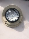
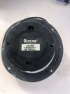
I’ll have to try that. My Ritchie compass has a big bubble and it’s not refillable. I’m due for another one.
 

seasick

Well-Known Member
Joined
Aug 19, 2008
Messages
9,531
Reaction score
1,420
Points
113
Location
NYC
I’ll have to try that. My Ritchie compass has a big bubble and it’s not refillable. I’m due for another one.
If there isn't a fill hole, how did they fill it in the factory? Mine has a very slow leak and I filled it last year. It was pretty easy to find the fill port but not all that obvious as to how to fill it without leaving a bubble.
Just in case you do refill, note that early model used an oil but more recent years ( pretty far back) use a special fluid. Since I had nothing to lose, I used clear mineral spirits and it worked fine.
 

Hookup1

GreatGrady Captain
Joined
Oct 16, 2007
Messages
3,035
Reaction score
855
Points
113
Age
70
Location
Cape May, NJ
Model
Islander
Compas 1.jpeg Compas 2.jpeg

I talked to Ritchie years ago about refilling. It's usually a loosing proposition. It's a seal that eventually leaks. Sometimes its a hairline crack in the clear plastic cover. They put the fluid in a vacuum chamber to degas and maybe even fill them under vacuum. It's just not worth the trouble. The one I rebuilt years ago was never right and eventually it was replaced.
 

seasick

Well-Known Member
Joined
Aug 19, 2008
Messages
9,531
Reaction score
1,420
Points
113
Location
NYC
That's probably all true. I did it because I wanted to see what the job was like. Eventually, I will replace the compass.
 

Hookup1

GreatGrady Captain
Joined
Oct 16, 2007
Messages
3,035
Reaction score
855
Points
113
Age
70
Location
Cape May, NJ
Model
Islander
I bought the kit from Ritchie. Gasket, fluid, tool, instructions. Like you I thought it was doable. But in the end it was a waste.

The old compass's were a work of art. Quality materials and craftsmanship. Worthy of repairing. Today they are just another piece of plastic junk.

IMPORTANT UPDATE 04/24/2022: Ritchie Navigation is no longer offering our factory refurbishment program on Helmsman, Voyager, Explorer, or Sport series compasses.

Ritchie frequently Asked Questions...
 
Last edited:

Hookup1

GreatGrady Captain
Joined
Oct 16, 2007
Messages
3,035
Reaction score
855
Points
113
Age
70
Location
Cape May, NJ
Model
Islander
Hookup, if your charts and navigator are set on magnetic set your radar on magnetic and your overlay should be correct
So final answer is Garmin Preferences >> Units sets True or Magnetic for the whole system including the magnetic heading sensor. If you flip back and forth on a second display you will see the radar overlay, navigation chart, waypoint navigating to and Heading box update to the correct compass heading.

Garmin has it all figured out so pick your preference. I use my compass when navigating to a waypoint so Magnetic is my choice.
 
Last edited: