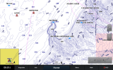
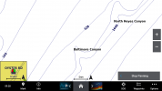
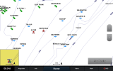
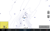
I got my screens powered up this morning. Here are the captured screen shots for the 943 and the 8610. I don't have my 4210 unit anymore but I'll give you screen resolution and you can imagine the difference.
4210 800 x 600 = 480,000 pixels.
943 1,280 x 720 = 921,000 pixels. This unit has 92% more pixels than the 4210.
8610 1,920 x 1,200 = 2,304,000. This unit has 150% more pixels than the 943.
8612 1,920 x 1,080 = 2,073,600. This unit has 125% more pixels than the 943 and 11% less than the 8610.
Baltimore canyon 3nm scale.
View attachment 27508 View attachment 27511
It you zoom out one click to 5 nm scale you cross the line where detail is dropped to display a larger area.
View attachment 27509 View attachment 27512
Go back the other way and zoom in to 0.5nm scale.
View attachment 27507 View attachment 27510
As you can see your field of view is substantially different between the units for a given scale. For chart plotting resolution matters. No so much with radar and sonar - but I haven't compared - to hard to do side-by-side comparison.
You get the same data from either unit but its harder to see what is around you or up the beach.
So as not to confuse anyone the 8610 had my NJ waypoint set loaded. The 943 did not. Does't affect the results.


