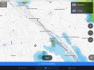
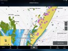
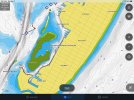
Remember guys, with the exception of sonar data generated and shared by users through the Active Captain App, the sounding data and detail is not new stuff. I suspect it is computer generated based on hydrographic surveys and sometimes near ancient sounding data and therefore not real. Most coastal and offshore soundings were done years ago and many are simply spot soundings. When was the last time you saw a government survey vessel collecting depth data in your area. One foot depth contours for most areas are simply not realistic. Shading and detail is very nice, but often it is not actual recorded sounding data. It is likely computer interpolated and probably pretty close to real. The charts are not updated frequently with regard to NOTAM (notice to mariner) publications. For instance it will not have changes to aids to navigation that are recent (maybe years old) or recent shifts in channels. Bottom line for me, is for coastal stuff in shallow, Google earth is pretty informative, but I won't pay a lot for revisions and fancy shading. Of course I'm an old timer that used DR for years and then got LORAN which I thought was amazing! Little did I know. All the additional detail and bells and whistles is nice, but as someone once said "that gun don't shoot that straight!"


